 By Saksham Arora
 At the southern edge of Bengaluru, the city’s long industrial corridor begins to meet the Karnataka–Tamil Nadu border. Factory buses move past Attibele town, trucks turn towards warehouses and engineering units, and commercial vehicles continue along Hosur Road carrying automobile parts, machinery, packaged goods and industrial materials.
This is Attibele Industrial Area, an established manufacturing belt within Anekal taluk. Its position between Bengaluru and Hosur gives businesses access to two major industrial economies. The area supports engineering, automobile components, industrial machinery, electrical products, plastics, packaging and warehouse-led operations.
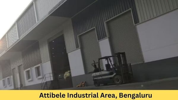
Attibele Industrial Area Overview
| Particular | Details |
| Location | Attibele, Anekal taluk, Bengaluru Urban district |
| Common PIN code | 562107 |
| Industrial authority | Karnataka Industrial Areas Development Board and local authorities, depending on the property |
| Main approach road | National Highway 44, commonly called Hosur Road |
| Other important road | Attibele–Sarjapur Road |
| Nearest operational metro station | Delta Electronics Bommasandra |
| Metro line | Namma Metro Yellow Line |
| Nearby railway options | Heelalige, Anekal Road and Hosur |
| Nearby localities | Neralur, Yadavanahalli, Chandapura, Bommasandra and Hosur |
| Common industries | Engineering, automotive components, machinery, electronics, plastics and packaging |
| Best suited for | Manufacturing, warehousing, industrial supply and interstate distribution |
Attibele is situated close to the junction of NH 44 and the road towards Sarjapur. The town lies around 32 kilometres from central Bengaluru and directly adjoins the Karnataka–Tamil Nadu border. Its wider industrial belt extends towards Neralur, Yadavanahalli, Balagaranahalli and neighbouring villages.
Where Is Attibele Industrial Area Located?
Attibele Industrial Area is located in the southern Bengaluru region under Anekal taluk. It lies along and around the Bengaluru–Hosur corridor, close to the state border. The area should not be viewed as a single compact factory complex with one entrance. Industrial plots and private manufacturing properties are spread across Attibele and adjoining village roads.
Neralur forms an important part of the surrounding industrial landscape. The wider Attibele belt also includes industrial activity near Yadavanahalli, Ichangur, Vaddarapalya and Balagaranahalli. Therefore, visitors should confirm the factory name, plot number, village and nearest highway junction before travelling.
The location gives businesses access to Electronic City, Bommasandra, Chandapura and Bengaluru on the northern side. Hosur, one of Tamil Nadu’s major manufacturing centres, lies towards the south. Sarjapur and the eastern Bengaluru business corridor can be approached through Attibele–Sarjapur Road.
Connectivity
1. Metro Connectivity
Attibele does not currently have its own operational metro station. Delta Electronics Bommasandra is the nearest terminal station on the Namma Metro Yellow Line for many employees and visitors. The station began operations with the Yellow Line in August 2025 and connects Bommasandra with Electronic City, Central Silk Board and onward parts of Bengaluru.
The remaining journey from Bommasandra to Attibele requires a BMTC bus, cab, auto-rickshaw, company vehicle or private transport. Travel distance depends on whether the unit is near NH 44, Neralur, Yadavanahalli or an internal industrial road.
An extension of the Yellow Line from Bommasandra towards Attibele has been examined, and a detailed project assessment was assigned. However, this proposed extension should not be treated as an operational transport facility until construction and public opening are officially completed.
2. Road Connectivity
NH 44, widely known in Bengaluru as Hosur Road, is the main transport corridor serving Attibele. It connects the industrial area with Chandapura, Bommasandra, Electronic City, Bommanahalli and Central Silk Board. Southbound traffic can continue towards Hosur, Krishnagiri and other parts of Tamil Nadu.
Attibele–Sarjapur Road provides an alternative connection towards Sarjapur, Dommasandra and eastern Bengaluru. This route is useful for businesses supplying customers around the Sarjapur Road, Whitefield and Outer Ring Road regions.
The border location is a major advantage for interstate movement. At the same time, traffic can become heavy near Attibele Junction, Chandapura and the Karnataka–Tamil Nadu border. Trucks may face delays during peak hours, roadworks or enforcement checks. Businesses using large trailers or containers should inspect the entire route leading to the selected plot.
3. Railway Connectivity
Heelalige Railway Station is a practical suburban railway option for employees travelling from the Chandapura and Bommasandra side. It connects with Bengaluru and destinations along the railway corridor towards Tamil Nadu.
Anekal Road Railway Station is another option for units situated towards the interior Anekal side. Hosur Railway Station may be more convenient for factories located closer to the border or for passengers coming from Tamil Nadu.
Railway stations in the region mainly serve passenger movement. Businesses requiring regular freight handling should separately examine cargo terminals, road-to-rail transfer facilities and loading arrangements.
4. Bus and Local Transport
BMTC buses connect Attibele with Electronic City, Bommasandra, Chandapura and central Bengaluru. Route 360B is among the services associated with travel between Bengaluru and Attibele through the Hosur Road corridor. Private and interstate buses also operate towards Hosur and other Tamil Nadu destinations.
Public transport is easier to find along NH 44 and around Attibele town. Factories situated inside village roads or industrial layouts may require company buses, vans or last-mile autos. Dedicated staff transport is especially useful for night shifts.
5. Airport Connectivity
Kempegowda International Airport is located on the opposite side of the Bengaluru metropolitan region. The road journey is long and can vary greatly depending on city traffic.
Business travellers generally use routes through Electronic City, the Outer Ring Road and northern Bengaluru. Air cargo users should allow sufficient time for movement between Attibele and the airport.
Facilities in Attibele Industrial Area
1. Industrial Space and Warehousing
Attibele offers independent factories, production sheds, industrial plots, workshop buildings and warehouses of different sizes. Some properties are located in planned industrial layouts, while others operate from privately developed or industrially converted land.
Common activities include:
- Automobile and engineering components
- Food-processing and grain-handling machinery
- Electrical and electronic products
- Industrial cleaning equipment
- Plastic and rubber products
- Metal fabrication and machining
- Packaging materials
- Warehousing and distribution
- Industrial maintenance and repair
The area is suitable for companies that need access to both Bengaluru and Hosur. It is also useful for suppliers serving the larger Electronic City–Bommasandra–Hosur manufacturing corridor.
2. Business Support Services
The surrounding industrial ecosystem includes transport companies, machinery-repair workshops, fabricators, labour contractors, packaging suppliers and automobile-component dealers.
Banks, ATMs, fuel stations, restaurants, pharmacies and daily-use shops are available around Attibele town and along Hosur Road. More extensive hospitals, hotels and organised commercial facilities are available towards Chandapura, Electronic City and Hosur.
Businesses requiring specialised testing, heavy-machinery maintenance or advanced corporate services may depend on suppliers from Bommasandra, Electronic City, Bengaluru or Hosur.
3. Utilities and Employee Requirements
Electricity supply in the region is handled through the state power network. Attibele Industrial Area and adjoining villages have been covered by KPTCL and BESCOM maintenance programmes, showing the importance of the local high-voltage distribution network. Individual businesses should still verify sanctioned load, transformer capacity, outage history and backup-power requirements.
Water availability, drainage and wastewater disposal can vary considerably from one plot to another. Manufacturing units should check the legal water source, borewell permissions, stormwater drainage and effluent-treatment requirements.
Rental accommodation is available around Attibele, Neralur, Chandapura, Bommasandra and Hosur. Companies employing workers from different states may need staff housing, canteen facilities and organised transport.
Company List in Attibele Industrial Area
Public business and address records have associated the following companies with Attibele or its immediate industrial belt. Exact unit locations and present operating status should be confirmed before visiting.
| Company or Business | Main Segment |
| Bühler India | Food-processing, grain and industrial machinery |
| Rosenberger Electronic | Electronic and connectivity components |
| Tennant India | Industrial cleaning equipment |
| Tyrolit India | Abrasives and industrial tools |
| Nash Industries | Precision engineering and manufactured components |
Apart from these companies, the area contains numerous smaller engineering, automotive-component, plastic, fabrication, warehouse and packaging businesses. Company names and occupants may change because some industrial properties are leased or divided among multiple units.
Why Businesses Choose Attibele
Attibele’s biggest advantage is its border location. A company can serve Bengaluru’s technology and manufacturing corridor while remaining close to the factories and supplier networks of Hosur.
NH 44 supports movement towards Electronic City, central Bengaluru, Hosur and Tamil Nadu. The operational Yellow Line up to Bommasandra has improved public transport for part of the journey, although Attibele still depends heavily on road-based last-mile transport.
The area is particularly suitable for automotive suppliers, engineering businesses, machinery manufacturers, warehouses and companies serving customers in both Karnataka and Tamil Nadu.
Its limitations include highway congestion, varying internal-road quality and uneven utility conditions across different plots. A business should inspect the exact property rather than judging the whole industrial area only from its highway location.
Frequently Asked Questions
Q1. Does operating near the state border create additional transport requirements?
A: Interstate goods movement may involve permits, tax documents, vehicle compliance and customer-specific paperwork. Businesses should confirm the current requirements for the goods and vehicles they use.
Q2. Can a residential building near Attibele be converted into a factory?
A: Not automatically. The land use, building approval, road access, power load, fire clearance and pollution category must permit the proposed industrial activity.
Q3. Is Attibele suitable for a cold-storage or food warehouse?
A: It can be suitable because of its highway access, but the property must have adequate power, backup systems, loading space, hygiene arrangements and food-related approvals.
Q4. Can heavy trailers enter every part of the industrial area?
A: No. Some units are approached through village roads or narrow internal stretches. Trailer operators should survey turning space, bridge limits, road width and overhead obstructions before beginning regular movement.
Q5. Should a company depend entirely on the proposed Attibele Metro extension?
A: No. The present transport plan should be based on NH 44, buses, staff vehicles and the operational metro terminal at Bommasandra. Any future extension should be treated as an additional benefit only after it officially opens.